Skip to primary navigation Skip to content Skip to footer

Reach Us

Google Map

(808) 756-­3335

Manta Ray Snorkel Check-in:

78-7130 Kaleiopapa St.,

Kailua-Kona, HI 97640

Open Monday - Sunday:
7 am - 7 pm HST

Directions

Keauhou Pier: 78-7130 Kaleiopapa St., Kailua-Kona, HI 96740

Scroll below for 1-tap mobile device directions in Google Maps, Waze, and Apple Maps.

Cancellation Policy

24 hours prior to the tour start time (when booking directly with us). The policy may be different if booking with third-party vendors/partners.

Hawaii Island has one main road that circles the island. It has several names depending on location – Hawaii Belt Road, Mamalahoa Highway, Queen Ka’ahumanu Highway, Highway 11, and Highway 19.

Directions from Hawaii Belt Road to Keauhou Pier

  1. From Highway 11 (aka Hawaii Belt Rd.) turn towards the ocean onto Kamehameha III Rd.
  2. Continue downhill on Kamehameha III Rd for 1.5 miles, then turn left onto Ali’i Dr. heading south (second stop light).
  3. Continue on Ali’i Dr. for 0.8 miles, then turn right onto Kaleiopapa St. (next stop light)
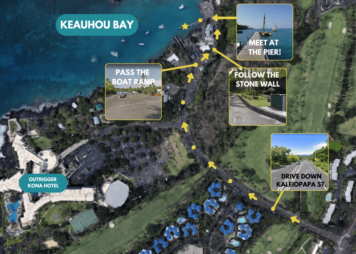
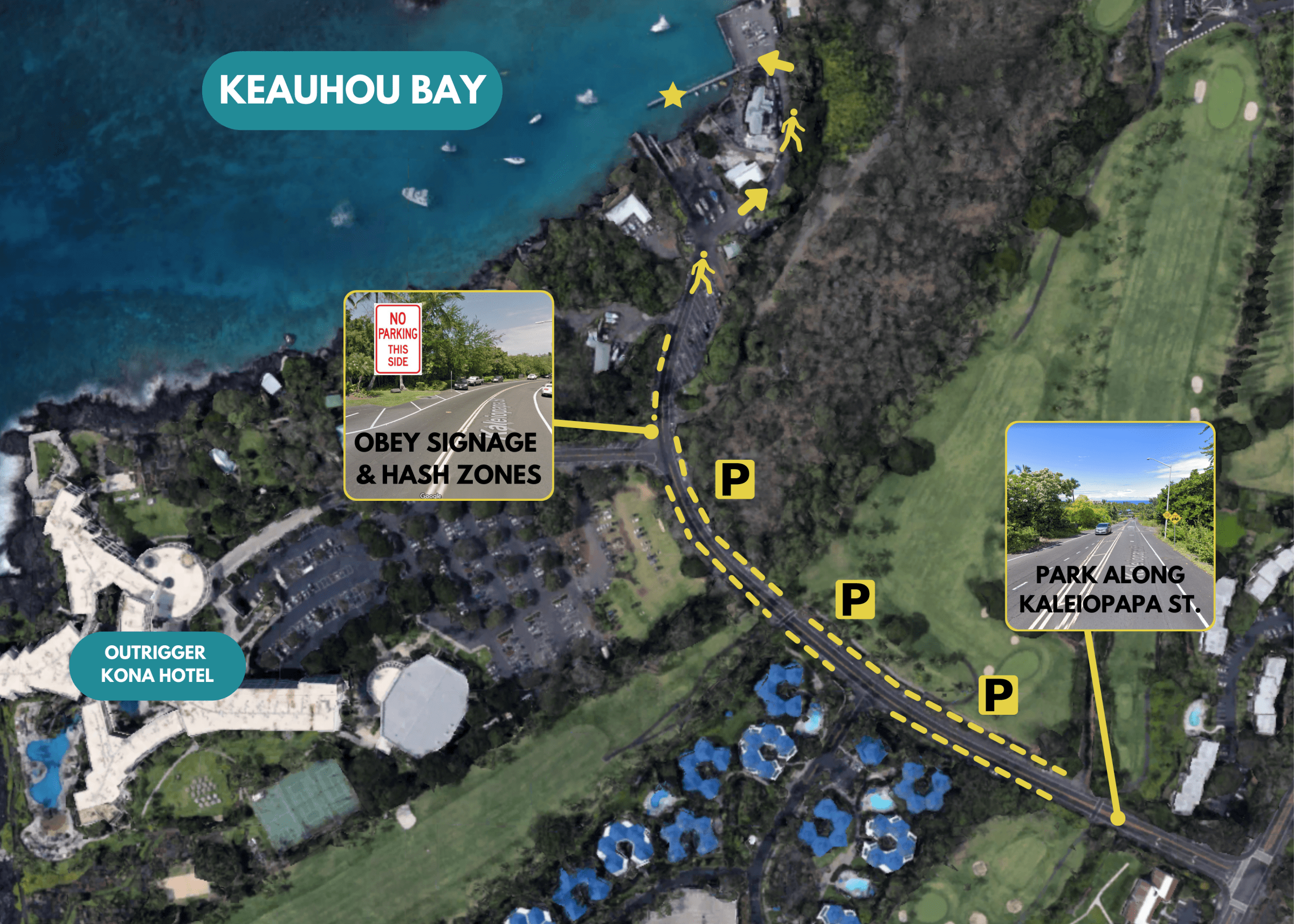
  4. On Kaleiopapa St. you can park in most places along the shoulder unless otherwise posted.
  5. Continue on foot down Kaleiopapa St. You will pass a trailer parking section (do not park here) and follow a short rock wall on your right. You will come to a small parking lot and pier after a brief 3-minute walk.

You can park in the pier parking lot as well if you’re fortunate enough to find a spot.

Eka Wayfinding Map

When you’re trying to keep your bearings in Kona, remember the ocean is West!

Keauhou / Kaleiopapa St. Parking Map

Keauhou Parking Map